
Xi Jinping-led China’s move to divert flow of the southern-bound river towards Tibetan Plateau threatens to convert northern part of India into a desert, writes Gopal Misra
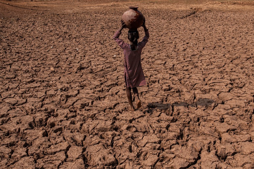
India being the frontline country having nearly three thousand kilometres of her borders with Tibet, now under the Chinese occupation, is alarmed by the new reports that China under Xi Jinping has begun diverting the flow of the southern-bound river towards Tibetan Plateau. It is being apprehended that if this is allowed, northern India would soon be rendered as desert.
A full detailed study has already been submitted to the country’s security establishment, including the office of the National Security Adviser, Ajit Kumar Doval, Defence and foreign ministries. The Union Government is reportedly studying various dimensions of this Chinese mischief or a ‘war on India’. It has been prepared by a noted irrigation expert, S.K. Kumar, and was quietly forwarded by Yogendra Narain, a former Defence Secretary of India.
There is an apprehension that Dragon may use water as a weapon to subjugate the South Asian region. These war plans were earlier detailed on a web platform, Sohu, a Beijing-based online media, though later, its details were denied by the Chinese foreign office. It is being stated that China has to wage a war during 2020-25 to annex Taiwan and five years later it will be attacking India’s Arunachal Pradesh.
The USA is Isolated
It is natural for New Delhi to be worried by Xi Jinping’s new avatar, who has finally shed off the use of ”cooperative” rhetoric and the avoidance of controversy of his predecessors Deng Xiaoping and Hu Jinatao in 2023.
The new aggressive diplomacy is being described by the western powers as wolf warrior diplomacy. As a part of this new initiative, China successfully gets Iran and Saudi Arab to restore their diplomatic ties. He also tells Ukraine that it has to agree for a ceasefire with Russia, if it wants its existence as a nation. Amidst these developments, two major European powers, France and Germany tell the USA that they would be with NATO as a supporter of Ukraine, but they might not be allying with any American action in Taiwan.
After conquering Taiwan during 2020-25, the website has revealed it would be the turn of Southern Tibet (2035-40) i.e. Arunachal in India. It will be the “reconquest” of Southern Tibet. The diversion of the flow of rivers could be a part of this new war strategy.
It appears that China has already embarked upon its war strategy for using the river water as a new weapon in subjugating its neighbors. According to statistics in the next seven year i.e. by 2030, the world’s population would reach 8.5 billion marks – Indians and Chinese accounting for one-sixth each of this growth, also it means more dependence on the diminishing water resources.
Since rivers and aquifers cannot be confined within political boundaries, therefore all nations’ interdependence is growing as fast as their population. This has added an ominous dimension to this precious resource – withholding and using it to intimidate, coerce and ultimately as a weapon of mass destruction by unleashing artificial floods and/or droughts. We are already facing this heat from China, our northern neighbour across the Himalayas.
Grand Designs of China
Most of the major rivers of Asian continent which provide water to the 29 per cent of the world’s population living in South Asia, from Afghanistan to Vietnam, originate in the plateau of Tibet which is also called the Third Pole for water with nearly 46,000 glaciers. They include Sutlej, Indus, Brahmaputra, Karnali, Irrawaddy, Salween, Mekong, Yangtze and Huang He (Yellow River)
China’s territorial disputes with all her neighbors are as much about dominating rivers as occupying land. Ever since the present Communist regime gained control of China they have been focusing on storage of freshwater. China’s water resources are unevenly distributed. The better developed northern regions, where its 42 per cent population resides have only 14 per cent of its freshwater.
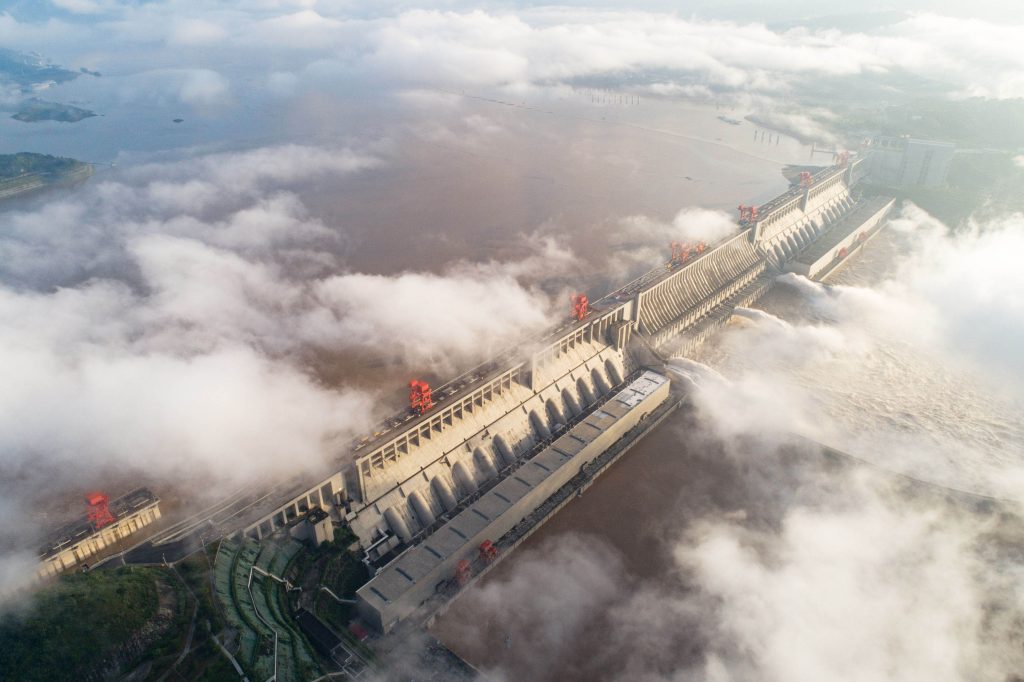
The agrarian South, comparatively less developed is water surplus with an 86 per cent share. China has built numerous dams and reservoirs following Chairman Mao’s earliest dictum of carrying water from surplus south to arid north. Gaining control over Tibet was also a part of this strategy. Today China has about 98,000 dams or water storage structures of various kinds. Of the world’s total large dams, China accounts for the most – 20% of them. World’s largest reservoir is created by China’s Three Gorges Dam on Yangtze River, which stores 39.3 billion CUM (31,900,000 acre feet) of water with a surface area of 1,045 sq km (403 sq miles). Three Gorges is also the world’s largest power station.
The challenge for India
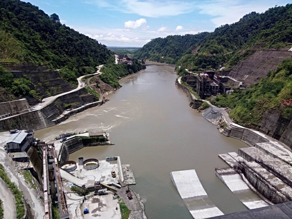
Without much fanfare and publicity associated with Three Gorges, China has been quietly blocking and diverting the flow of Brahmaputra. Zangmu Dam was built by China in the middle reaches of the river, a few kilometers from Bhutan-India border with power generation becoming fully operational in October 2015.
It is being claimed that the reservoir is just a run-of–the-river- power project, but reports suggest that the Chinese have plans to divert water up to 200 billion cubic meters for irrigating the deserts of Xinjiang, Gansu and Inner Mongolia. Three other such dams are coming up at Dagu, Jiexu and Jiacha, all in the same geographical location. China has also blocked Xiabuqu, a 195 km long tributary which joins Brahmaputra at Xigaze close to the Indian state of Sikkim. It is here that construction of a dam on Xiabuqa was started in 2014 which was expected to be completed by 2019, forming part of Lalho hydroelectric project. In November 2020, China’s 14th Five Year Plan for 2021 – 2025 announced construction of a huge 50 meters high dam with power generation capacity of 60-gigawatt on Yearlong Tango (Brahmaputra) River in the Tibetan Autonomous Region (TAR) of China in the foothills of the Himalayas. This planned mega-dam could produce as much as three times the hydropower being produced at their current largest dam, the Three Gorges. It is located just 30 kilometers from the Indian border, this dam plan has caused great alarm and consternation in India and Bangladesh, and not without reason. The challenge to the very continuity of their major water resource has come right up to the door and effective countermeasures by both countries are urgently called for.
River Brahmaputra (Yearlong Tango)
Also called Yearlong Sango or Yaluzangbu, it is the upper stream of Brahmaputra River originating eastwards near the holy Mansarovar Lake in western Tibet. Three other important rivers completing four prime directions from Mansarovar Lake are Indus (north), Sutlej (west) and Karnali (south) – the last one ultimately joins Ganga. Yearlong Tango flows at the height of nearly 5000 meters above sea level, making it the highest river in the world. Then the river plunges 2700 meters at the Grand Canyon of the East – deepest in the world and at 504.6 kilometers, slightly longer than the Grand Canyon of the United States. The precipitous fall makes it particularly conducive for harnessing hydroelectric power. Flowing eastward for 1625 kilometers in Tibet, the river takes ‘Great Bend’ towards south-west and enters India in Arunachal Pradesh as the Siang. Further down after the confluence with the Dibang and Lohit, it is known as the Brahmaputra. After traversing through Assam, it merges with the Ganga in Bangladesh and empties into the Bay of Bengal.
It is just at this Great Bend that China’s new super hydropower dam is proposed to be located. Damming up the river at Great Bend will not only give China near total control over Brahmaputra flow to India, but is also riskier because it is in a high seismic zone. It has been the epicenter of some of the most severe earthquakes over the century including the devastating 1950 earthquake that changed the course of Brahmaputra in Assam and perished thousands.
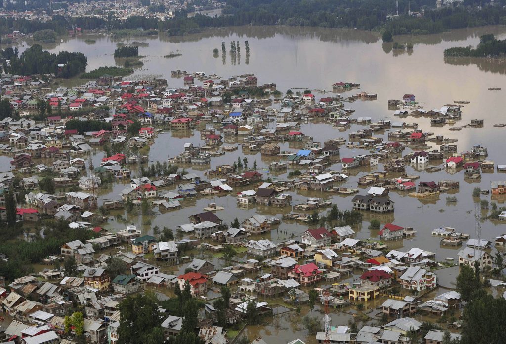
Brahmaputra accounts for nearly 30 per cent of India’s freshwater resources. A perennial river, it is the lifeline for communities living along its banks for irrigation, fisheries and inland water transport. Consequences of China diverting or withholding the waters of Brahmaputra could be damaging for all these. It could seriously affect the navigability of National Waterway-2, the 890 km stretch from Sadiya to Dhubri by substantially reducing the minimum required water depth. A huge dam in close vicinity would also hold back the massive amount of fertile silt being carried by the river. Although China claims that all these ventures are just “run-of-the-river” hydropower schemes – not involving any diversion of water, but they certainly have the leverage to withhold and divert it to their arid regions and causing drought here during keen irrigation demand. Also they can release it during monsoons, causing flash floods in Arunachal Pradesh and an already flood-prone Assam.
Other Indian Rivers too at risk
China plans to tap waters of most of the big rivers flowing from the Tibetan plateau. They have already built a barrage on Sutlej River without informing India, and let us not forget that the first “temple of resurgent India” – Bhakhra Dam is situated on Sutlej River. Some of Nepal’s major rivers originate in Tibet and finally merge into the Ganga in India. Of them the most important is Nepal’s longest, Karnali (507 km). Tibet is also the origin of some parts of Kali Gandak, Budhi Gandak and the larger part of Trishuli which are major tributaries of the Gandak River system. Similarly major tributaries of the Kosi River such as the Sun Kosi/BhoteKosi, the Tama Kosi and Arum originate in Tibet. Flowing through western, central and eastern parts of Nepal respectively, Karnali (becoming Ghaghra in India), Gandak and Kosi enter India and join Ganga.
Nepal alone accounts for 46 per cent of the flow in the Ganga and its contribution grows to 71 per cent during the lean season. What would happen to the Ganga if dams and diversion works are built on its major tributaries flowing from Tibet into Nepal? Although it might not be feasible to create reservoirs by building dams so near the origins of these rivers in Tibet, but Nepal has suitable sites for such construction. China is already working towards developing road connectivity with Nepal and also to sell generated hydropower to Nepal. China’s next move may be to convince Nepal to allow it to build reservoirs on Ghaghra, Gandak and Kosi rivers in Nepal and get more and cheaper – maybe free – hydropower. For China, it would mean further promotion of cross-border integration with Nepal, gaining sizable control over water flow in the Ganga basin, which is our grain bowl, and causing more problems for India as well as Bangladesh.
It is clear that China wants to fully exploit its status as an upper riparian state– which allows “restricted territorial sovereignty” as per international law — by trying to replace in practice the keyword “restricted” by “absolute”. By the same law, it also has an obligation to protect the interests of lower riparian nations. There is frenzied dam building in China bordering on paranoia, but there is no arrangement between China and any other lower riparian country on water sharing. Fact is that far from any water sharing mechanism, Beijing is reluctant to share even the hydrological data with the lower riparian countries.
China has the maximum number of lower riparian states in the world – sharing rivers originating from it. But so far it has not entered into a comprehensive river water sharing agreement with any of them. On the other hand, since 1950s, more than 200 agreements have been developed between riparian nations all over the world that address issues of water management including information exchange, monitoring and evaluation, flood control, hydropower projects and allocations for consumptive or non-consumptive uses in international basins. A case in example is Indus Water Treaty for water distribution between India and Pakistan signed and ratified in1960, which is considered one of the most successful and durable water sharing endeavors in the world today, because the two nations have not engaged in any water wars despite their several military conflicts.
China should have concluded Water Treaties with India, Bhutan and Bangladesh – for Brahmaputra basin; with India, Pakistan and Afghanistan – for Indus basin; with India and Pakistan for Sutlej basin; with Nepal and India – for Karnali, Kosi and Gandak basins; with Myanmar, Thailand, Laos, Cambodia and Vietnam – for Mekong basin; with Myanmar for Irrawady basin; and with Myanmar and Thailand for Salween basin. It has stoutly refused to do so, except a few MoU’s only for supplying hydrological data, which too are not always compiled in letter and spirit.
It is hoped that the Indian establishment would soon be able to spell out its strategy for dealing with this new Chinese aggression.
Meanwhile, there are five principles of international water law: principle of equitable and reasonable utilization; Obligation not to cause significant harm; principle of notification, consultation & negotiation; principle of cooperation and information exchange; peaceful settlement of disputes. These principles are enshrined in 1966 Helsinki Rules, 1997 UN Watercourses Convention, 2004 Berlin Rules, and several Water Treaties including 1960 Indus Water Treaty.
Can India corner China at UN water meet?
It is necessary to bring international pressure on China on this issue. It should be taken up to UNO with India taking the lead. In every continent, the distribution of river waters among the countries is regulated by precise water Treaties or Agreements. In South Asia, we have the Indus Water Treaty-1960 between India and Pakistan, Indo-Bangladesh Treaty, Indo-Nepal Treaty and Mekong Agreement and procedural Rules 1995. European Treaties include Danube River Protection Convention and Finland-Sweden Agreement on Trans boundary Rivers 2009. There are agreements between the USA and Canada on the Great Lakes Water Quality and Boundary Waters Treaty. Similar Treaty exists between the USA and Mexico on the Rio Grande Waters. Africa has Nile waters agreement 1959 between Sudan and Egypt. There is the Amazon Cooperation Treaty Organization 2004 in South America among member states of Bolivia, Brazil, Columbia, Ecuador, Guyana, Peru, Surinam and Venezuela.
China – being the upper riparian state of the largest number of rivers – therefore has no valid argument or reason to openly defy this accepted civilized convention.
There will be a UN Water Conference in 2023 itself where Trans-boundary and International Water Cooperation is the main item on the Agenda, and the focus would be to make sure that countries deliver on promises already made. China exactly falls in this category. In a recent article carried by the state-run ‘Global Times’, China had expressed willingness to have multilateral cooperation with India and Bangladesh to share waters.
Retracting on the statement, two days later, the Chinese Foreign Ministry’s official spokesperson went on to state that effective cooperation regarding sharing data on the flow of rivers already existed. It clearly shows that China is not willing to commit water sharing with lower riparian states through proper Agreement or Treaty and feels providing hydrological data – as and when it suits them – is the end of their responsibility. International pressure can bring China to the table for inking Agreements for judicious water distribution with all downstream user nations. Indeed, it is a huge task to get anything agreed by the Chinese.
Meanwhile, there are five principles of international water law: principle of equitable and reasonable utilization; Obligation not to cause significant harm; principle of notification, consultation & negotiation; principle of cooperation and information exchange; peaceful settlement of disputes. These principles are enshrined in 1966 Helsinki Rules, 1997 UN Watercourses Convention, 2004 Berlin Rules, and several Water Treaties including 1960 Indus Water Treaty.
Painstaking research
S.K.Kumar, an octogenarian engineer and scholar will be completing 85 springs of his life on coming November 26, but his enthusiasm and dedication continues to inspire the generation next. A post-graduate in Physics, he did his civil engineering from the country’s oldest engineering institution, the then Roorkee University, now called IIT. He served the UP’s Irrigation Department, and after his superannuation, he became the member of the UP Public Services Commission. The present study is based on his life-long research and dedication. Apart from serving his home state, he has been associated with various institutions of the Union Government as well as other state governments.
Driving a wedge
An MoU was signed on 5th June 2008 between China and India, according to which the former would supply hydrological data of Brahmaputra River only in Flood Season at three identified stations. But China is weaponising even this information, which is binding on it, as a tool for coercion by withholding data from India. It was refused by them during the height of Doklam crisis, but according to sources the data was continued to be provided to Bangladesh. China prefers to deal with issues bilaterally, rather than multilaterally, which gives it more flexibility to bend the negotiations in its favour and to drive a wedge between India and Bangladesh.


