
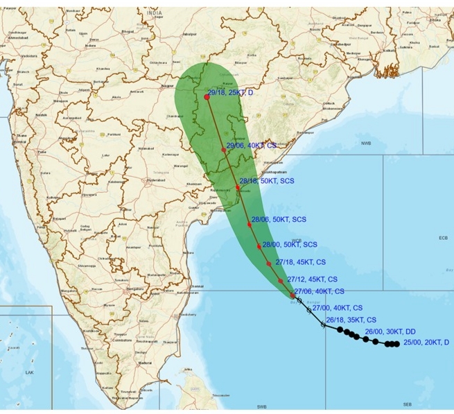
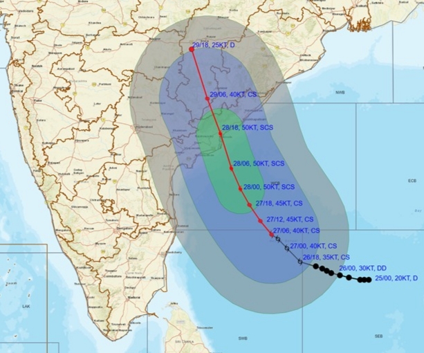
The depression over the southeast Bay of Bengal intensified into cyclonic storm “Montha” and is expected to strengthen further by the morning of October 28. According to the India Meteorological Department (IMD), the system is likely to cross the Andhra Pradesh coast between Machilipatnam and Kalingapatnam, near Kakinada, during the evening or night hours, as a severe cyclonic storm with maximum sustained wind speeds of 90–100 kmph, gusting up to 110 kmph.
The storm will bring heavy rain and strong winds over Andhra Pradesh, Yanam, Telangana, south Odisha coasts, Chhattisgarh, and Tamil Nadu for the next two to four days. The IMD has advised fishermen not to venture into the southwest and adjoining central Bay of Bengal and along the Tamil Nadu, Andhra Pradesh, Yanam, and Odisha coasts until October 29. Those already at sea have been urged to return to shore immediately.
Heavy to very heavy rainfall is forecast for the coastal districts of Andhra Pradesh and parts of Odisha, Tamil Nadu, and Telangana between October 27 and 30, accompanied by high waves and rough to very rough seas along the coastline.
The Bay of Bengal frequently spawns powerful storms due to its warm sea surface temperatures and the funnel-shaped coastline, which amplifies wind, rain, and storm surge impacts.
What’s in a name?
The name “Montha” was submitted by Thailand broadly means “fragrant flower” or “beautiful flower” in Thai.
In the North Indian Ocean region, cyclones are named once they reach a specific intensity and are officially classified as a “cyclonic storm” by the IMD. The naming process follows a rotating list prepared by member countries of the World Meteorological Organization (WMO) / ESCAP Panel on Tropical Cyclones, which includes nations like India, Thailand, Bangladesh, Oman, and others. Each country contributes names in advance, which are used sequentially as new cyclones form.


